Father Pierre Jean De Smet, S. J., together with his fellow Jesuit Missionaries, Fathers Gregory Mengarini and Nicolas Pointe and three Lay Brothers first entered the Bitterroot Valley on September 24, 1841. The wagon and three carts holding their supplies were the first "vehicles" to enter the area. They established the first white settlement in what was to become Montana, on the east bank of the Bitterroot river, immediately west of the present town of Stevensville. The new mission, as well as the river and the tallest mountain peak to the west, were named "St. Mary's". Fifty years later the name of the river was changed to "Bitterroot" by the Forest Service.
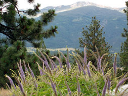
The Salish considered the Peak to be sacred and was a place for a Vision Quest. Today, hundreds of hikers visit each summer to view the timeless scene of the Bitterroot Valley first witnessed by the Catholic Missionaries more than 160 years ago.

St. Mary's Peak - Stevensville, Montana
St. Mary's Peak
~ Elevation 9300 ft
~ Trailhead Elevation 6900 feet
~ 4.5 miles from parking area to the summit and the fire lookout station.
~ Moderately difficult climb.
~ Allow a full day to hike.
~ Hike smart - Take along extra food, water, mosquito repellant, a First Aid Kit and warm clothing as the weather can change.
For current conditions and info contact the Stevensville Ranger District at:406-777-5461 or visit the Bitterroot National Forest website.
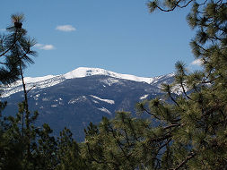
St. Mary's Peak rises 9300 feet above sea level and over 6000 feet above the valley floor. At its pinnacle is a fire lookout station that offers breathtaking views for miles around.The 4.5 mile hiking trail is considered moderate in difficulty, although there is a 2400' gain from the parking area to the top.
Directions to St. Mary's Peak
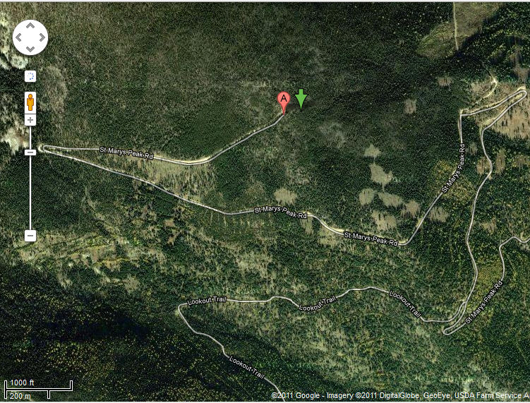
Travel 3.5 miles south of Stevensville junction on Highway 93. Turn west on Indian Prairie Loop. Continue west 1.8 miles to St. Mary's Road, turn right and continue 1 mile to McCalla Ridge Road and St. Mary's Peak Road 739 junction. Travel on that road about 14 miles to the road's end at the trailhead.
Hiking Info
Best time to hike is late June through September. Hike earlier in the day to avoid the afternoon thunder showers that often occur in late summer. The parking area accommodates 10 vehicles and can fill up quickly on weekends. Go early.
History of St. Mary's Peak
406-777-5734
Email: stmary@cybernet1.com
www.saintmarysmission.org

The trail is open to:
Walking
Horseback riding
Click image for larger view
Latitude:46.50034 N  Longitude:114.20248 W.
Last Update: 8/24/2016
Historic St. Mary's Mission, Inc. * All Rights Reserved
Web Site Design by S&J Enterprises
P.O. Box 211
315 Charlo Street
Stevensville, MT 59870